These three nautical charts of the Cook Islands are published by Land Information New Zealand.
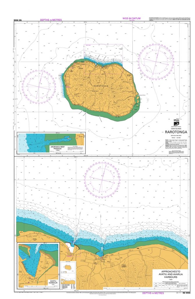
Rarotonga
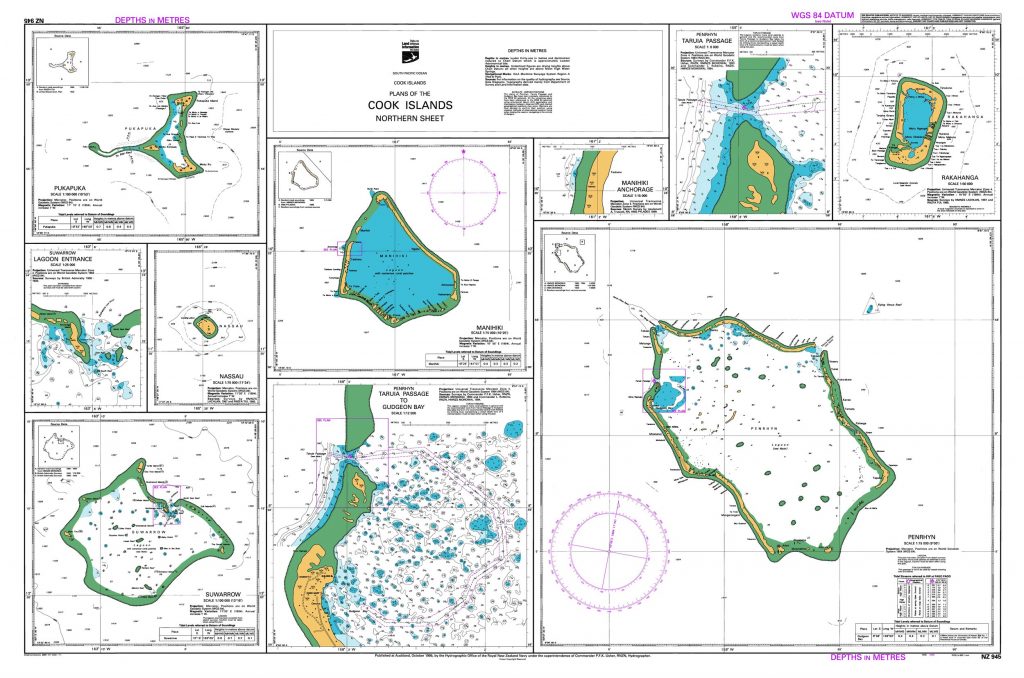
Plans of the northern Cook Islands
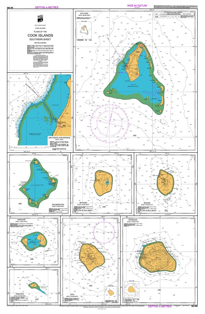
Plans of the southern Cook Islands
This work is based on/includes LINZ’s data which is licensed by Land Information New Zealand (LINZ) for re-use under the Creative Commons Attribution 4.0 International licence.
Many more maps of the Cook Islands are available from TROPICARTA (requires Chomikuj account).